K2- the Savage Mountain
Pakistan |
K2, the second highest mountain in the world (8,611m/28,251ft), is not as well-known as her big sister Mt Everest (8849m/29,031ft) but she is a far more difficult and dangerous mountain. One of every four climbers who climbs K2 dies in the process, compared to one in ten on Mt Everest. Similarly, the treks to their base camps are completely different. Everest Base Camp (on the Nepalese side) sees about 45,000 people per year while only about 1,000 attempt to reach K2 Base Camp.
Reaching K2 Base Camp was my goal on arriving in Islamabad, Pakistan in early August. Islamabad, a planned capital city developed in the 60’s, reminded me very much of Canberra in Australia. A government city with wide streets, little traffic, abundant greenery and a man-made lake. Islamabad is actually so orderly that its suburbs are known as E-11, F-6, G-8 etc.
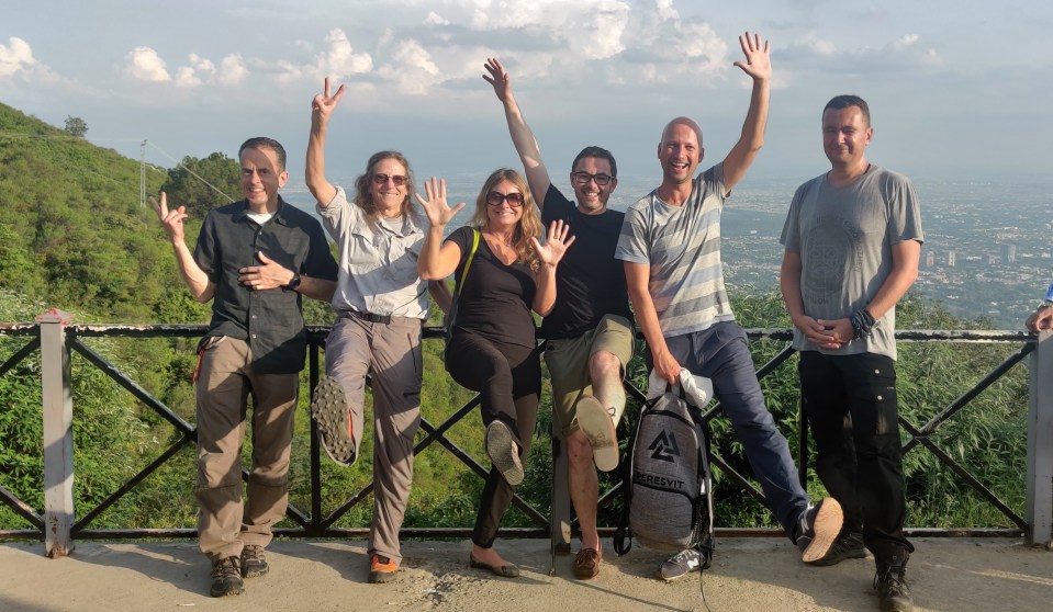
Our group of 11 did a quick tour of the city and surrounding hills but were eager to leave the city and head to the mountains. That night we did a dance to the weather gods to ensure that our flight to Skardu the next morning was able to proceed. Our alternative was a 2 day drive and we wanted a birds-eye view of the mountains from the sky. Luckily good weather prevailed, and the hour-long flight gave us glimpses of the magnificent mountains below.
We based ourselves in Skardu for a couple of days while waiting for the appropriate authorizations for our trek and filled our time with shopping in the bazaar, renting mountaineering gear, watching the local polo teams play and visiting ancient forts. One of the highlights was a swim in a beautiful lake outside of Skardu, surrounded by mountains.
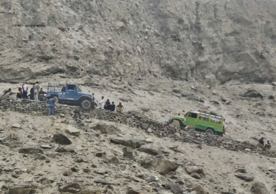
Then it was off in our convoy of Toyota jeeps – ideal for the rough roads here. A 9 ½ hour journey that encompassed navigating a nail-biting narrow track, precariously hewn into the cliff-face with a glacial river raging far below us, with only inches between our wheels and the edge of the road. Rickety wooden suspension bridges – that sometimes needed to be mended before we could pass – were common. The scenery was stunning – and we soon learned not to bother asking for names of anything but the biggest mountains – anything under 6000m doesn’t really count!
On arrival our camp-site was well appointed, our tents were comfortably set up, the food was plentiful and tasty and we were eager to get on with trekking. The next two weeks (we hiked/camped for 14 nights in total) would soon fall into a familiar pattern. Wake up early, breakfast, hike, break, hike, break, hike, lunch, hike, break, hike, break, get into the next camp around 2-3pm, tea and snacks, rest, read, nap, play cards, eat dinner, play cards, sleep, repeat.
We hiked for 6-8 hours a day, gradually gaining a few hundred metres in altitude each day. Most of the hike was on the Baltoro Glacier, one of the longest glaciers in the world outside of the polar regions. We hiked on the moraine, the rocky debris covering the ice, which occasionally meant somewhat challenging hiking as we navigated boulders and rocks and meandered up and down the glacier but, for the most part, the hiking was not too difficult. While there were a few in the group who were clearly faster, it was a relief to find that many of us hiked at a relatively similar pace.
Far more concerning was the occasional river crossing – usually these could be skipped over on rocks but one or two required getting your feet wet in glacially cold water and trying not to get pushed in by the current (actually very dangerous). Interestingly the Pakistani guides have a tradition of carrying females over the river and so the three women on the trip were piggy-backed across. We weren’t sure how to feel about this – and how much to protest with “I can do it myself” – but seeing the cold grimaces on our male companions faces made us sure we had made the right choice.

Given we were in a border sensitive area with the Indian and Chinese borders close by, most of the camps we stayed in also hosted army personnel who spend 6 months patrolling the area. At one camp we also met a group of 20+ mountaineers who had successfully summited K2 and were on their way down. It felt like being in the presence of royalty given that less than 400 people (ever!) have made the summit. (Everest has been climbed more than 9000 times).
While a number of people suffered from the normal altitude related ailments – diarrhea, vomiting, nausea, headaches etc – nobody became too sick to continue. And the plentiful and hearty food every day – soup, bread, dahl, pasta, rice, apricots, fresh goat and chicken (yes – slaughtered on the mountain) – kept us strong. We were also lucky with the weather – despite one rain/rest day, we were able to hike all other days without being rained on in a significant way. And many evenings were clear for some magnificent star-gazing.
However, the big question as we slowly ascended to Concordia – the crux of the hike at 4,700m and where K2 would become visible – was whether we would make it over the Gondogoro La Pass located 1000m above us. Crossing the Pass would mean one difficult climbing day (using our crampons, ice axe, fixed ropes etc) and no need to retrace our steps back the way we had come. But it could only be safely crossed in good weather, and we had seen many groups that had turned back due to bad weather on the Pass.
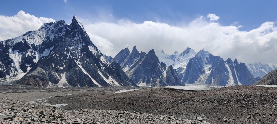
On arrival at Concordia, the view of K2 was magnificent, made even better by Broad Peak (another 8000m+ mountain) standing next to her. Our itinerary had included another days hike to camp at K2 Base Camp but the weather forecast was predicting bad weather in a couple of days so, wanting to give ourselves the best chance of crossing the Pass, it was decided that we would try to get to K2 Base Camp and back to Concordia in one day. As it turned out this was significantly more strenuous than expected, including an hour and a half trying to make our way through giant ice crevasses on the glacier, and only the three fastest of our group actually make it to K2 Base Camp; the rest of us made it to Broad Peak Base Camp at 5000m, just 2 hours hike shy of our goal. Such is the way of the mountains – and big groups!

Unfortunately, the weather forecast got even worse and crossing the Pass was not considered safe so we turned around to head back down again – disappointed at not making the Pass – and, for most of us, not making K2 Base Camp. The reality is that the view is much better from Concordia and there is not much to see at Base Camp anyway – but still! So back down the Baltoro glacier we trudged.
Back in Skardu we headed off in multiple directions. Myself and one other team member decided to head back to Islamabad along the Karakoram Highway – an 18 hour journey that was well worth it with beautiful scenery. The road is known for landslides and we crossed slides that were kilometres wide that had closed the road just the night before. Scary! It also gave us a chance for a little more interaction and – as is often the case in countries that are little visited by Western tourists – we found the people incredibly welcoming and generous – not letting us pay for our lunch, giving us free gemstones with our purchases etc.
I hope that I get a chance to come back to Pakistan in the future. As the world’s fifth most populous country, there is still so much to see and explore. A big thank you to the team at Apricot Tours who looked after us so well and to my fun trekking companions who made the journey so enjoyable!
Planned, green Islamabad in the background … some of the trekking group getting to know each other 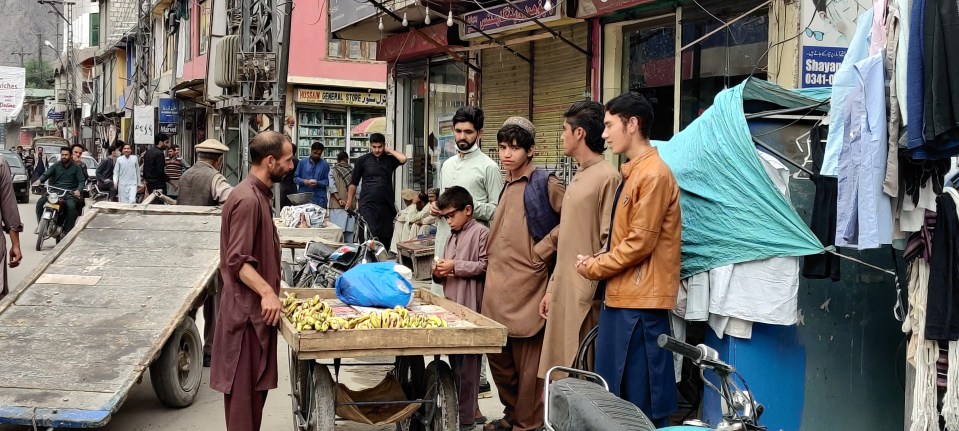
Street scenes in Skardu 
Typical Pakistani truck 
Skardu Polo match 
Tourist Police 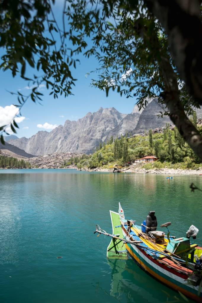
Beautiful Kachura Lake 
Skardu sunset Note the wheel over the edge! These jeeps are the transport of choice. 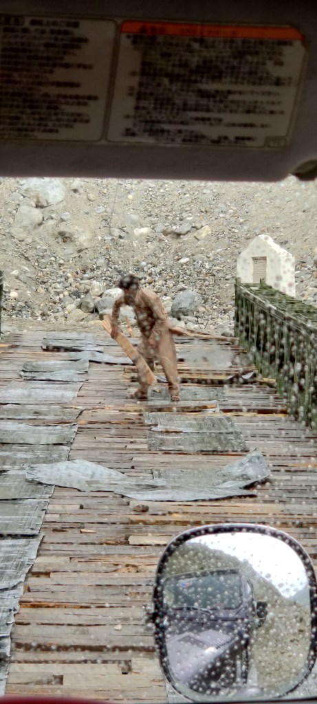
Fixing the bridge before we drive over it 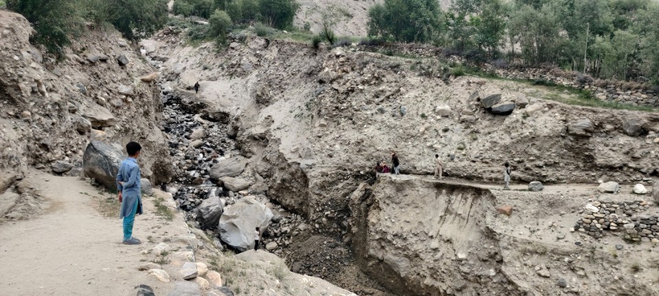
Road completely gone! We walk across and change jeeps on the other side 
Village kids 
More village kids 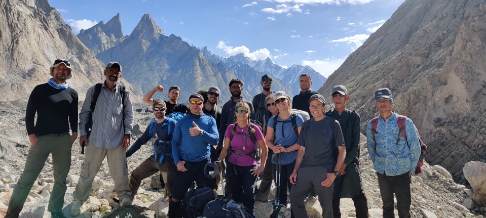
Ready to hike! 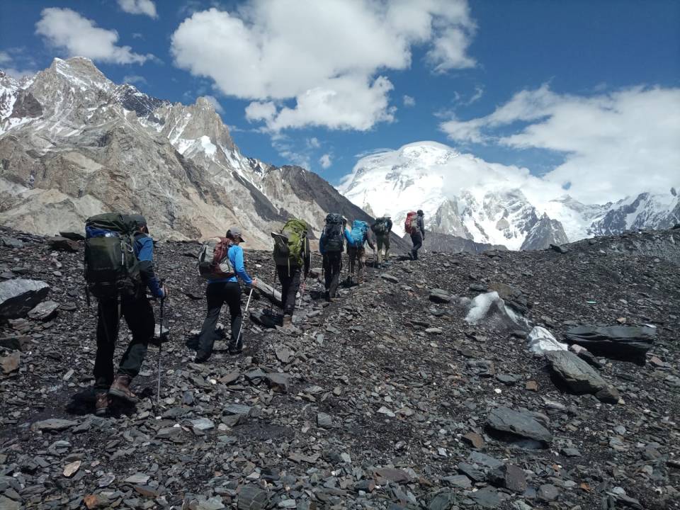
Off we go… 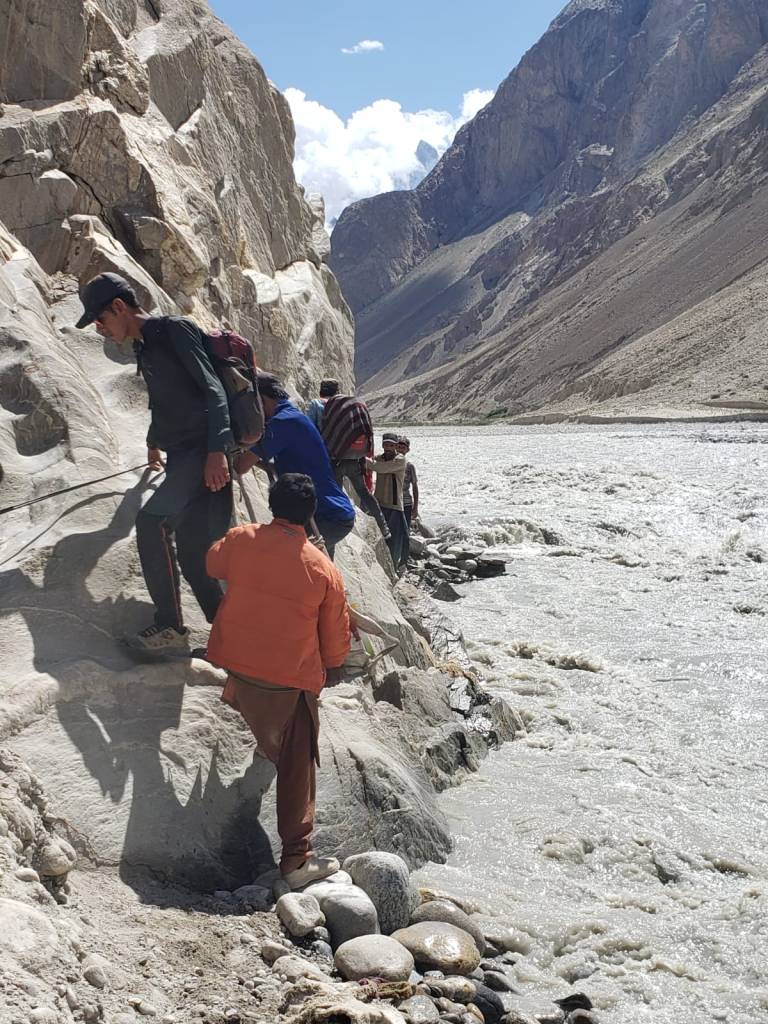
A tricky bit.. Another tricky bit – girls getting carried across the river… 
Typical dinner/breakfast scene 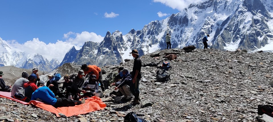
Typical lunch scene 
Typical camp scene 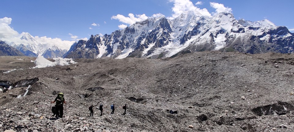
Typical hiking scene 
Plenty of glaciers 
K2 and me! Concordia Camp with K2 view 
Starting to tackle the glacier 
K2 Base Camp 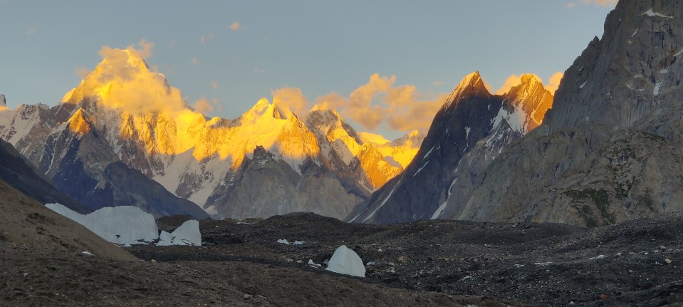
Sunset views 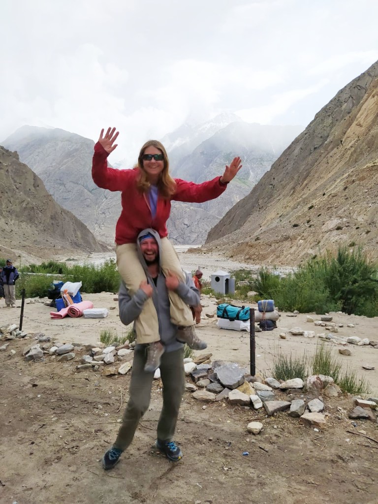
Celebrating with K 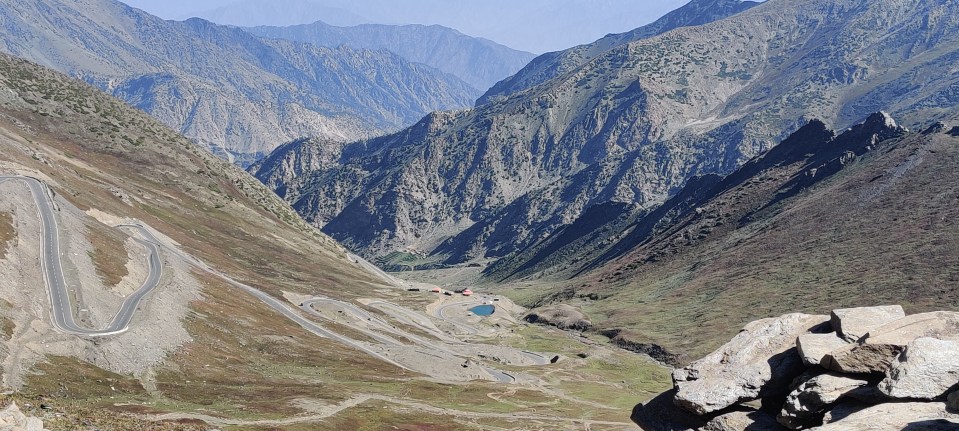
Karakoram Highway Pass 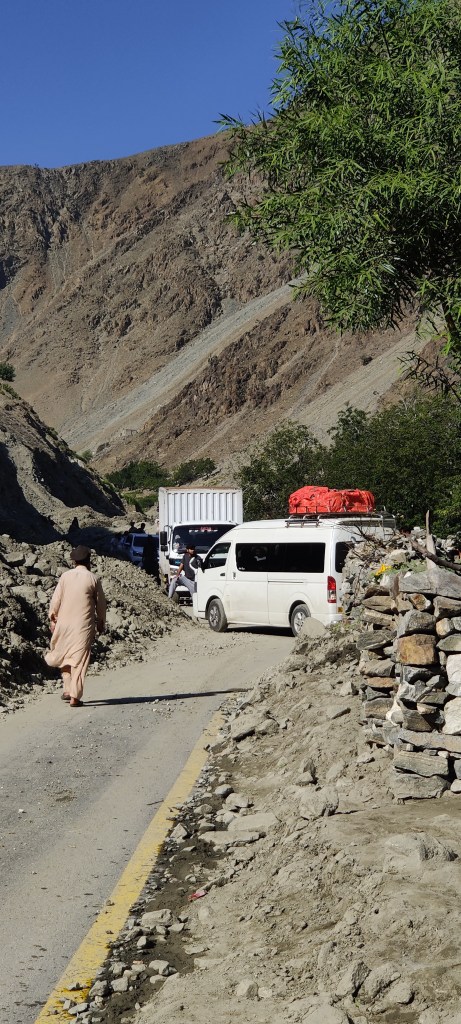
Landslide from the previous night – kilometres of it!
Amazing! Bravo!
Thanks for always reading Wayne!
Crikey what an epic adventure – loved the read.
Epic is a good way to describe it!
Amazing to see this Nikki.
Thanks for being such a dedicated reader Sue!
This looks and sounds like a real adventure, loved the challenges you crossed to reach such beauty. Bravo for Pakistan. I too cannot wait to go visit. Keep those stories coming….
Thanks Gaye! It was special….
what an amazing adventure – feels like I was there with you
As my most constant travel companion It’s kind of strange you weren’t!! :-).
Oh soooo jealous! I’m looking forward to doing some serious hiking again hopefully next year!
And you’ll be even more off the beaten track!